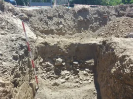
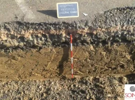
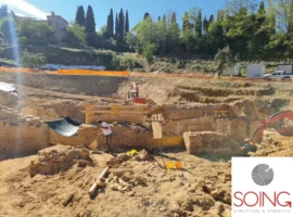
Geophysical investigations now represent a fundamental tool for prior assessment of archaeological risks. Thanks to geophysical surveys in various stages, from the full exploration of large areas of interest using continuous methods over a short space of time (with electromagnetic technique or GPR), followed by detailed geophysical surveys with 2D and 3D electrical tomography, up to positioning excavations in order to verify and calibrate the archaeological interpretation of the data acquired during the previous phases.
To date this is an established method which begins should it be necessary to verify and analyse the historical and archaeological information of a site of interest, and therefore for a pure process of knowledge acquisition, or in the case of casual findings while providing archaeological support during excavations for public works or the like, in archaeological at-risk areas.
Thanks to overlaying all levels of information: historical, geophysical, archaeological, geographical and geological, we are able to create raw maps with GIS systems which allow us to comprehensively interpret all the data and to reach consistent and reliable archaeological assessments.
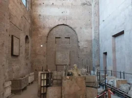
Between December 2012 and March 2015, SOING directed the research and development project funded by the Tuscany Region with the call for tender R & D 2012, POR CReO 2007-2013 ERDF funds, the Linea di Intervento (project) 1.5a. The project called “Primarte- a network integrated approach for innovation in diagnostic methods and intervention on the artistic and architectural heritage” had a positive outcome and the results achieved have been very important at all levels. The final technical evaluation was carried out by Prof. Cinzia Buratti of the University of Perugia.
One of the objectives of the project focused on the synergistic application of various innovative methods, in addition to traditional ones, on the same “pilot site” in order to carry out diagnostics of the cultural heritage in an effort to integrate different disciplines efficiently and to convey an across the spectrum innovation message for the conservation of cultural property.
SOING carried out both penetrating radar surveys of the wall structures of the chapel of St. Antonio Abate in Le Campora, a wonderful surviving part of the monastery of Santa Maria al Sepolcro in Le Campora, not far from Porta Romana in Florence, and surveys on the areas outside the chapel, with the purpose of searching for archaeological traces of the monastery. The archaeological research experience was extremely important because it allowed us to work closely with art and architecture historians and restorers in addition to refining our analysis, investigation and integrated interpretation procedures.
- Research and mapping of underground structures with non-invasive geophysical surveys
- Archaeological excavation testing
- Prior check of the archaeological interest (art. 95 of Legislative Decree no. 163/2006) in support of the preliminary project
- Preliminary archaeological reconnaissance
- Integrations with archival research and study of maps and aerial photos
- Archaeological Support
- GPR
- 2D and 3D electrical tomography (ERT 3D)
- Electromagnetic surveys
- Visual checks and direct testing
- Surveys with automated Total Station and GPS differential
- Videoendoscopy
- Petrographic analysis